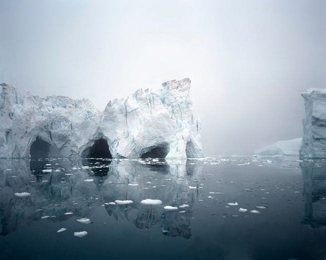
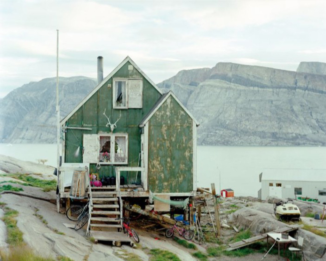
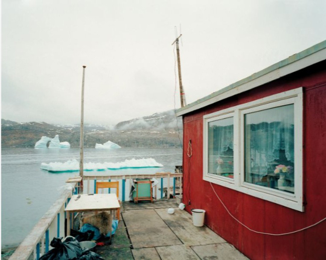
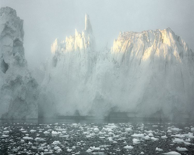
I’m not an aficionado of landscape photography. I suppose that’s not entirely true. I like to look at landscape photography. I find it visually appealing, but for me the appeal rarely expands beyond the eye. Part of that, I suspect, is because modern visual media have made us familiar with every part of the world. There’s almost nothing new to see in the landscape. We’ve all seen the Australian outback, we’ve all seen Brazilian rain forests, we’ve all seen Antarctica and the American West and the Swiss Alps and the deserts of Sahara. We’ve all seen the Earth from space. We’ve all been everywhere–in pictures.
So when I first glanced at the photographs of German landscape photographer Olaf Otto Becker, I saw nothing new. I was struck by their beauty, of course. I loved the formality of the composition and the subtle colors of the northern landscapes. Hauntingly lovely photographs–but I’ve seen tens of thousands of hauntingly lovely photographs. I probably would have left it at that, except that I noticed the titles of his Greenland photographs contained GPS data. A nicely modern touch. I wondered if it served a purpose or if it was just an affectation. It was enough to prompt me to glance at a few interviews with Becker.
In those interviews I saw what I’ve sadly come to expect from most interviews with photographers. Becker said almost exactly the same things thousands of other landscape photographers have said.
“I use the camera as a tool to understand the world around me.”
“I try to look at something as though my eyes had opened for the first time.”
“While traveling around [Greenland], I was constantly astonished, always awake, with my eyes wide open and observing.”
Of course his eyes were open, I thought; did he suppose we thought he was traveling through Greenland blindfolded? At that point I would have abandoned Becker if I hadn’t noticed a mention of a map. I’m a sap for a map.

Becker, apparently on a whim, had bought a map of Greenland. It was nothing special, just a map with a scale of 1:250,000. That’s the scale of most common motorist maps. What was interesting to Becker, though, was that the interior of the map was almost entirely blank. The center of the island is largely covered by a permanent sheet of ice. He was intrigued to discover the entire island–the planet’s largest island by area (Australia is considered a continent rather than an island)–seemed to be nothing but a handful of towns and villages clinging precariously to the coastline.
He determined to go there with his large format camera and photograph the villages. But where Becker’s work truly began to capture my interest was his decision to photograph the more remote parts of the coastline by boat. Let me just repeat that; Becker decided to photograph the coast line with a large format camera–a heavy camera that requires a stable platform–on a boat. Not just any boat, but a Zodiac, which is a small, inflatable, heavy-duty rubber dinghy. And he decided to do it alone. To truly comprehend the magnitude of that madness, it must also be understood that Becker had no idea at all how to handle a Zodiac.
The entire project sounds completely insane. I was immediately attracted to it.

Becker hired a local Inuk to teach him to use the small craft. He learned the only safe way to navigate an inflatable vessel in ice flows was to move at a walker’s pace. It is a pace, happily, that suited both Becker and his contemplative style of large format photography. A slow pace, however, is a disadvantage in an environment where the surface of the water can freeze suddenly, making it impossible to return by the same path by which you arrived–or in an environment where glaciers can calve without warning, creating mini-tsunamis–or in an environment in which one’s compass can be off by as much as thirty degrees because some of the local rocks are exceptionally rich in iron. In other words, an environment that can easily kill you, and kill you quickly.
Becker spent several summers with his 8×10 camera in the subarctic zones of western Greenland. Most of the photographs were taken at night, between the hours of 10 p.m. and 6 a.m. local time, when the northern light is at its lowest and most dramatic point.
Large format photography is, of course, a necessarily slow process. Determining what is to be photographed, setting up the tripod and the camera, adjusting the focus, studying the upside-down image in the ground glass–the procedure is almost a ritual. Because the preparation is so slow and methodical, the images produced by large format landscape photography often tend to have a formal, contemplative feel to them. That’s certainly true of Becker’s work.

But Becker works slowly even by large format standards. Over the course of four years, during which he traveled more than 11,000 miles in and around the arctic, Becker only shot around one hundred photographs. When a photographer shoots so few images, one has to assume that each of those images was carefully chosen and meticulously composed. One starts to ask “Why?” Why, for example, did Becker turn his camera on a rather ordinary-looking bridge of an isolated highway that disappears into a misty horizon?
The photograph of the highway isn’t a traditionally ‘pretty’ landscape picture. But it’s clearly not a random snap, the sort a person with a digital point-and-shoot camera might take. The image was composed with a purpose. The more I looked at Becker’s photographs and the more closely I read his interviews, the more I began to believe the purpose is to document the impact of humankind on the landscape.
Much of his work–indeed, most of it–appears to show an unspoiled world. We see, for example, a waterfall cascading off the side of a massive precipice, a river of bitterly cold water coming from the interior ice sheet on its way to the ocean. It looks so pristine, so pure, unsullied by humanity. Yet even though there are no people in the photograph, Becker is showing us the effects of people on the environment. The gentle arc of a highway is visible in the photograph, a modest scar on the landscape. What isn’t so readily apparent in the photograph is the fact that the ‘permanent’ ice sheet that covers 80% of Greenland’s interior is beginning to melt.

Although there is a timeless quality to the photographs, Becker is very aware of the relevance of time to landscape photography.
“When I am photographing, I am very conscious of what this same view might look like in fifty or one hundred years, even five hundred years. How will it have changed? Will all the ice and snow be gone?”
Given that the rate of ice-loss in Greenland has increased 250% in recent years and that approximately 59 cubic miles (248 cubic kilometers) of Greenland’s ice pack is now melting annually, Becker’s question is a fair one.
Olaf Otto Becker doesn’t take political photographs. He shoots landscapes. Yet he’s aware that a landscape is dynamic; it changes over time and many of those changes are a result of social and political decisions. His decision to include GPS data in the titles of his most recent work was done partly so he could return to the same location in the future, but also “for the future documentarians of global warming.” Becker readily acknowledges–even insists–that his primary interest is in taking pretty photographs, but he’s aware that his work is probably more important as documenting this moment in time.
A fellow German, Wim Wenders, once said “The most political decision you make is where you direct people’s eyes.” Landscape photographers like Becker, intentionally or not, are directing our eyes to what we’ve long considered to be the pristine corners of the world. And we’re learning they’re not quite as pristine as we’d believed.
Becker’s work is, as I said at the beginning, hauntingly lovely. It’s worthwhile for that reason alone. But, sadly, these photos may haunt future generations in more literal ways.
